Snow capped Mt. Rainier can be seen on Washington's license plate, from my window in South Tacoma, and from practically any street in Tacoma and Seattle. It's an hour and a half drive Southeast from Tacoma. To get to Mount Rainier National Park you take highway 7. The road to the mountain was a bit foggy:
 |
| All I could do is hope that the weather would clear up. |
On the way, I saw a huge bridge. Or so I thought.
I had to turn back around for a second look.
Please meet Alder Dam, which sits on the Nisqually River.
 |
| I'm sure this is an even better view on a sunny day. |
When construction of the Alder Dam finished in 1945, it was one of the tallest dams in the US. The water behind the dam is Alder Lake, pictures of which you will discover as you keep reading. (I encountered Alder Lake on the way to Mt. Rainier, and it's a popular recreation spot near the mountain).
 |
| Still gloomy. |
After some time, I see the sun starting to peek out, and then a large body of water emerges on my right.
 |
| First glance. |
Notice anything about the lake?
How about now?
At this point I hope you have noticed the beautiful color of Alder Lake. How does that happen you ask? Well when the glaciers from neighboring Mt. Rainier melt and the water makes its way into Alder Lake, the fusion gives off a gorgeous turquoise/aqua/
*insert descriptive color of your choice here* shade.
Some more views of the lake:
Thank you sky for clearing up so I can take in this beauty!
Some views of the road....
And finally!
First stop in Mt. Rainier National Park, at Kautz Creek:
T'was a quick stop for a photo op.
Next up, deer spotting!
 |
| Yup, it's just chilling on the side of the road, not afraid of cars or people. Brave soul. |
Next up was Cougar Rock.
 |
| Huge log, and yes, that's snow in the background. |
 |
| The same huge log, only this time with Mt. Rainier behind me. |
 |
| The Nisqually River. A fierce and powerful stream of water. |
 |
| Might as well touch the water! |
 |
| Alright, I made it to the edge of the water. |
 |
| And I touched it. It was freeeeeeeezzzzzzzing!!! |
My attempt at a Panorama shot
 |
| Bridge over Nisqually River. |
 |
| Treating the log as a balance beam and working on my gymnastic skills. |
 |
| Now that log is my surfboard. |
 |
| I got these rocks under control! |
 |
| Queen of the world! |
 |
| Posing. |
 |
| Can he make it to the top, while his human shadow turns into a shadow bear? |
 |
| Practice makes perfect. |
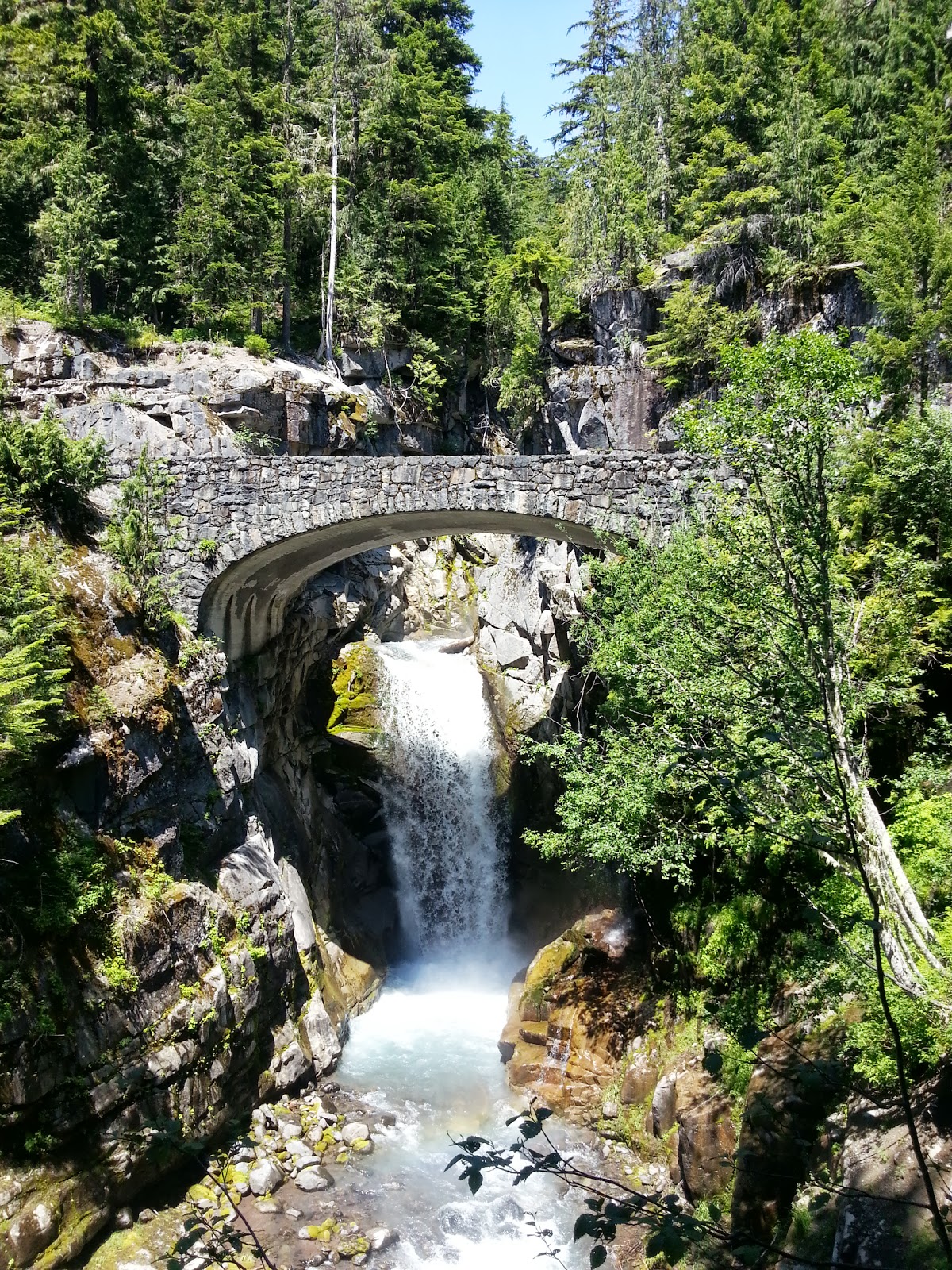
After some fun at Cougar Rock, the next thing to enjoy was Christine Falls.
 |
| That bridge is where the road runs. The view is better from here, not the bridge. |
 |
| Huge logs...everywhere! |
 |
| Time to dive! |
 |
| Yeah right. I'd kill myself on those rocks. |
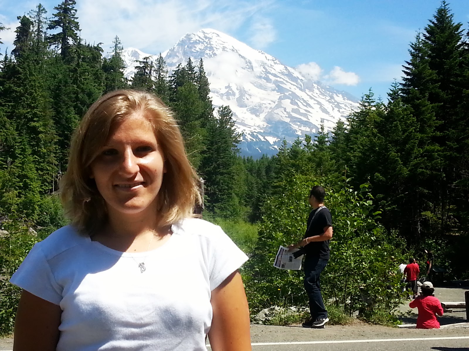
And back to the road it is, to get to the top, well as close to the top, of Mt. Rainier as possible. It's comprised of many different glaciers that create the numerous creeks in the national park. There is no road that will take you to its peak.
 |
| Getting closer! |
 |
| Ta-da! That's the closest I will get to Mt. Rainier. |
 |
| I love that the snow blocks are still intact, despite having a couple weeks with great weather. |
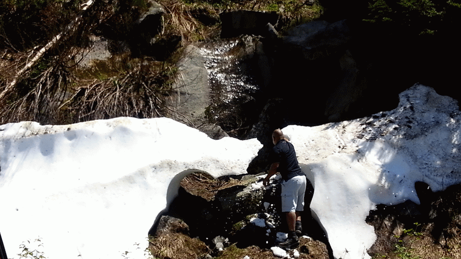
At this point, the road started heading downhill, and I thought it was a great opportunity to take advantage of the snow on the side of the road.
 |
| Yup, it's cold! |
 |
| Tagging the snow. |
 |
| Yup, I'm the boss. |
What happened in the following pictures can be left up to interpretation:
In reality, I was merely dancing in the snow.
Now that I had had my share of fun in the sun AND snow, I could head down the mountain, feeling accomplished. Until I saw this:
And my partner in crime proceeded to do this:
 |
| The finished project. |
And that, dear readers, was my visit to Mt. Rainier. There are a couple videos of this experience that unfortunately, due to current technical difficulties, will be uploaded later. Regardless, I didn't want to delay this entry any further.
Parting images:
Experienced on 7/7/13.